Preliminary Ecological Appraisal
microWild - Full PEA
Reference microWild CLG · 58.65 ha · Generated 30 October 2026 · Report 8998FEF0
This report covers the Republic of Ireland only. Its protected site, watercourse, wetland and geology data come from Irish state datasets that do not extend into Northern Ireland.
Executive summary
This desk-study report summarises ecological information for microWild - Full PEA, a study area of 58.65 ha. It brings together species records from iNaturalist and GBIF with national datasets on protected sites, watercourses, land cover, wetlands and geology.
The report uses 64 species records dated 2012 to 2025, covering 49 species. 5 species are of conservation concern. A further 29 records could not be reproduced because of their licence (see Data licensing).
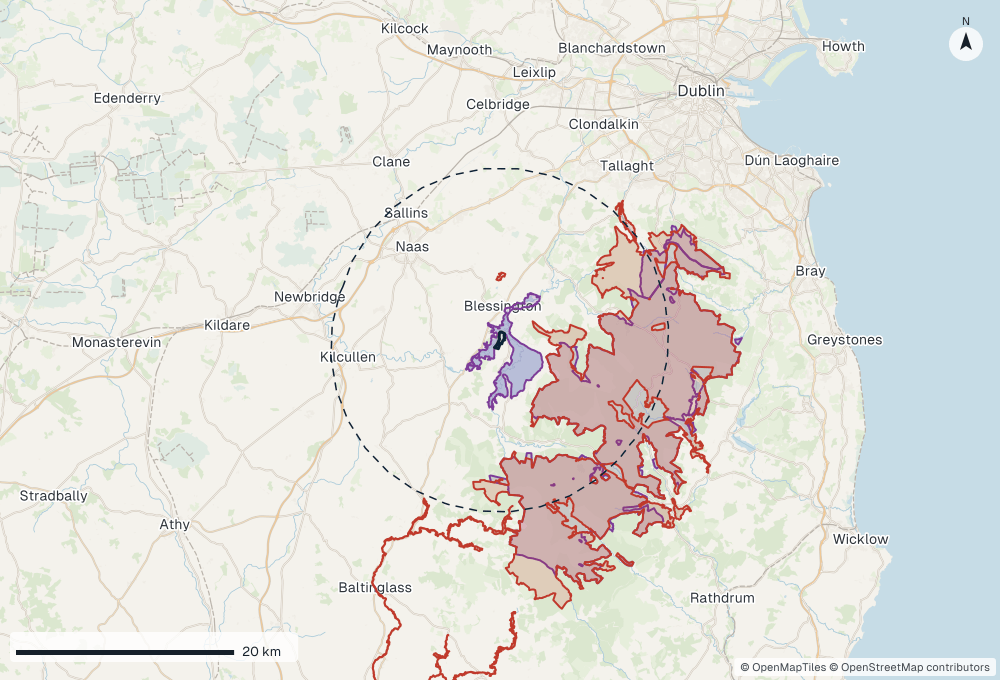
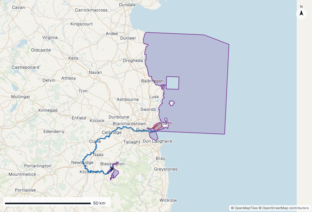
6 European sites lie within the 15 km search radius; the nearest is Poulaphouca Reservoir SPA (SPA, within or adjoining the study area). 2 nationally designated sites lie within the 5 km search radius; the nearest is Poulaphouca Reservoir (pNHA, within or adjoining the study area). Water from the study area reaches 5 European sites downstream; the nearest by water is Poulaphouca Reservoir SPA (under 1 km).
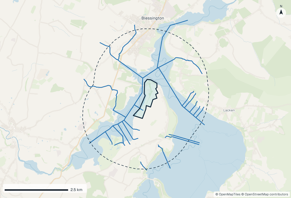
The site has 22 watercourses within 2 km, the nearest being Russelstown 09 (within or adjoining), land cover dominated by pastures (84.3%) and bedrock of the Aghfarrell Formation and Dolerite and others.
Site location
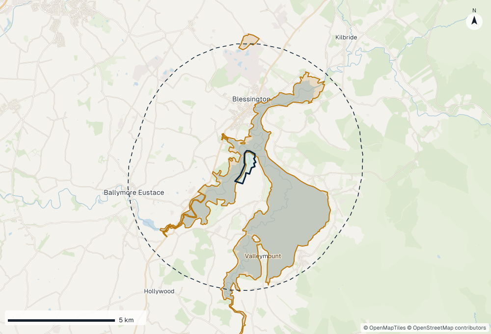
The study area is outlined on the map below. All distances in this report are measured from the edge of the study area, and directions are from its centre.
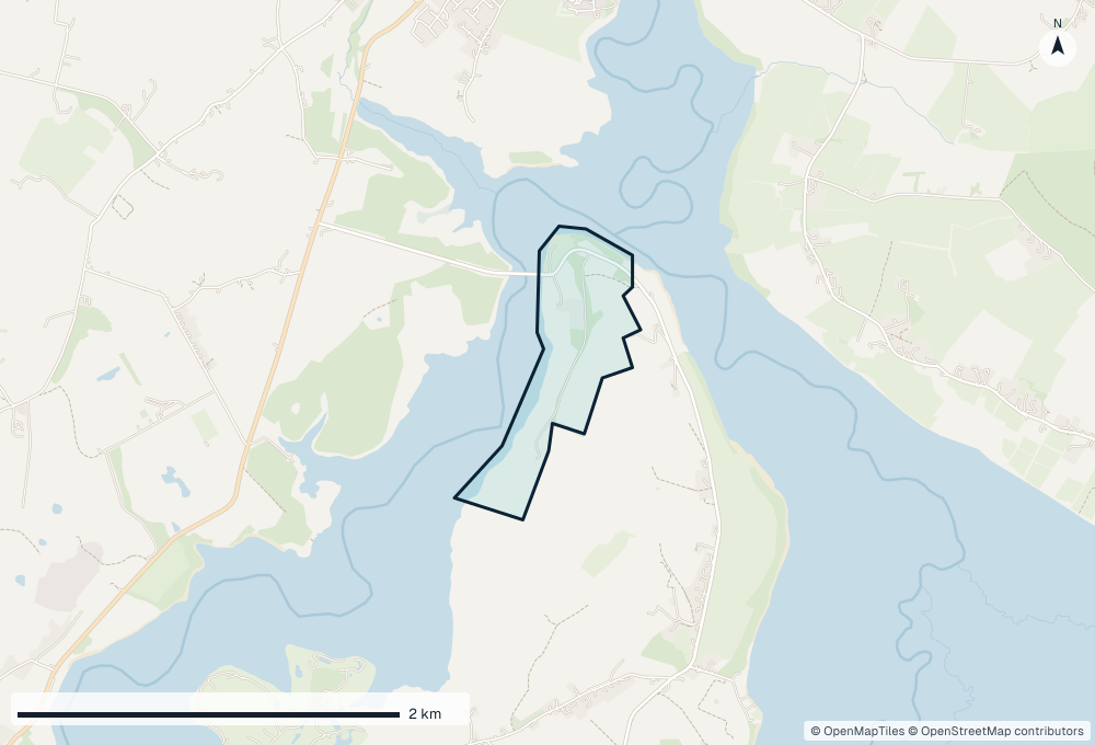
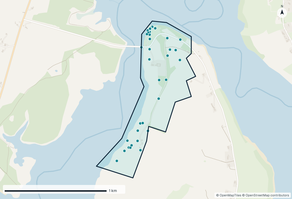
Protected sites for screening
Statutory protected sites near the study area, as a starting list for screening. European sites (Special Areas of Conservation and Special Protection Areas) are listed within 15 km, and nationally designated sites (Natural Heritage Areas and proposed Natural Heritage Areas) within 5 km, measured edge to edge. These distances are search radii for this desk study, not a zone of influence. In line with the Office of the Planning Regulator's Practice Note PN01 (2021), a project's zone of influence should be set case by case using the source-pathway-receptor model. It may include sites further away, for example downstream along a watercourse, or sites whose qualifying species, such as birds, bats or otter, range beyond their boundaries.
European sites within the 15 km search radius
| Site | Code | Type | Distance | Direction |
|---|---|---|---|---|
| Poulaphouca Reservoir SPA | 004063 | SPA | Within or adjoining | — |
| Wicklow Mountains SAC | 002122 | SAC | 2.8 km | E |
| Wicklow Mountains SPA | 004040 | SPA | 4.1 km | E |
| Red Bog, Kildare SAC | 000397 | SAC | 4.7 km | N |
| Slaney River Valley SAC | 000781 | SAC |
Watercourses
Rivers and streams within 2 km of the study area, from the EPA river network. Watercourses can carry effects to protected sites downstream, so hydrological links should be checked on site.
| Watercourse | EPA code | Stream order | Distance | Direction |
|---|---|---|---|---|
| Russelstown 09 | 09R06 | 1 | Within or adjoining | — |
| Lake (flow path) | IE_EA_09_71 | 6 | Within or adjoining | — |
| Russellstown 09 | 09R05 | 1 | 478 m | S |
| Unnamed stream | 09G39 | 1 | 800 m | S |
| Elverstown Great | 09E06 | 2 | 841 m | W |
| Unnamed stream | 09G41 | 1 | 1.0 km | S |
| Unnamed stream | 09G36 | 1 | 1.2 km | SW |
| Unnamed stream | 09D76 | 1 | 1.2 km | SE |
| Sroughan | 09S13 | 1 |
Species of conservation concern
Species recorded within the study area that are threatened or near threatened on an Irish Red List, Red or Amber listed under Birds of Conservation Concern in Ireland (BoCCI), or legally protected, grouped by type.
Birds (2)
Mammals (1)
| Common name | Scientific name | Irish Red List | Other status | Records | Latest | Record |
|---|---|---|---|---|---|---|
| Eurasian red squirrel |
Invasive species
Invasive species recorded within the study area, and how each is regulated in Ireland. Three lists apply side by side. The First Schedule of the European Union (Invasive Alien Species) Regulations 2024 (S.I. 374/2024) lists invasive alien species of national concern: it is an offence to introduce, keep, breed, transport, sell, exchange, grow or release them. The EU list of invasive alien species of Union concern (Regulation (EU) 1143/2014) applies directly in Ireland, with similar restrictions. The Third Schedule of the European Communities (Birds and Natural Habitats) Regulations 2011 (S.I. 477/2011) remains in force: under Regulations 49 and 50 it is an offence to plant, disperse or spread listed plants, or to release listed animals or allow them to escape, and removing listed species from a site needs a licence from the NPWS. Species marked No on all three are invasive in Ireland but not regulated.
No invasive species were found in the openly licensed records for the study area.
The First Schedule also lists the common toad, tawny owl and greylag goose throughout the State, and the fox, hedgehog and Irish stoat on offshore islands. They are not treated as invasive in this report: the listing controls their release, keeping and movement.
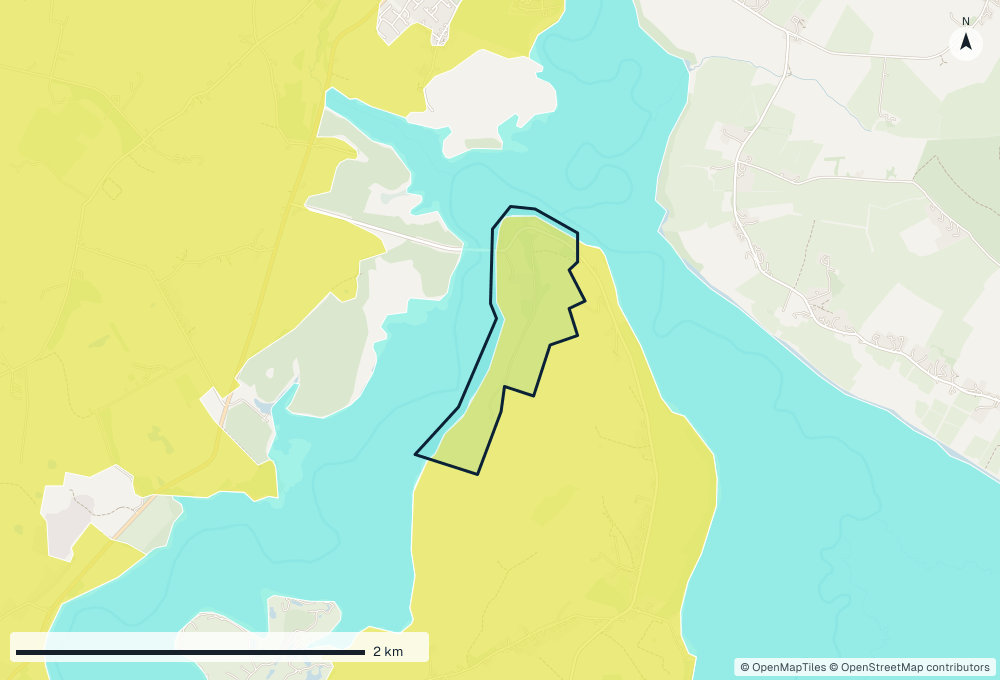
Land cover (CORINE 2018)
Land cover within the study area from CORINE Land Cover 2018. CORINE maps areas of 25 ha or more, so small habitats inside a site are often not shown.
| Land cover class | Code | Group | Area (ha) | % |
|---|---|---|---|---|
| Pastures | 231 | Agricultural areas | 49.39 | 84.3 |
| Water bodies | 512 | Water bodies | 9.17 | 15.7 |
Wetlands
Wetland sites within 300 m of the study area, from the Map of Irish Wetlands.
No sites from the Map of Irish Wetlands were found within 300 m of the study area.
Bedrock geology
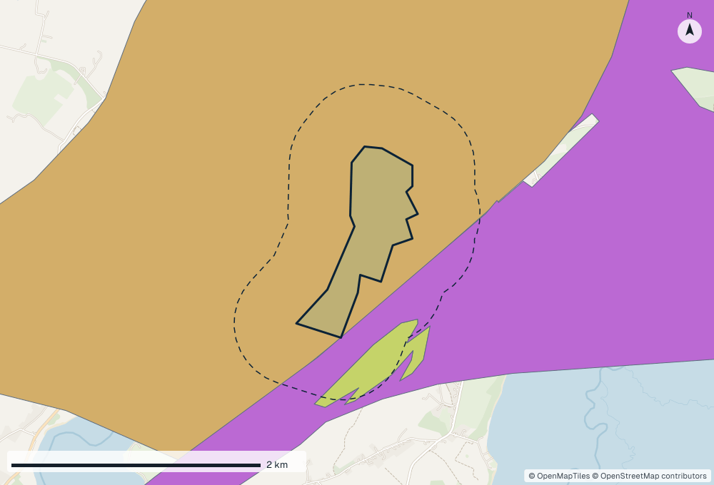
Bedrock formations within 500 m of the study area, from the Geological Survey Ireland 1:100,000 bedrock map.
| Code | Formation | Description |
|---|---|---|
| AG | Aghfarrell Formation | Greywacke siltstone, slate, quartzite |
| D | Dolerite | basalt and gabbro |
| PO | Pollaphuca Formation | Coarse greywacke & shale |
Data licensing
This report only reproduces records published under licences that allow commercial use (CC0, CC BY, CC BY-SA, CC BY-ND or the Open Government Licence). 29 records found for the study area are published under a non-commercial licence or no licence, so they are counted here but not listed.
21 species are known from these records alone; of these, 1 is of conservation concern and 1 is invasive. They can be viewed on the source websites, and using them in commercial work needs the recorder's permission.
In a real report, a private page lists these records grouped by recorder, with links to ask each one for permission.
References and data sources
- Species records
- iNaturalist, GBIF, retrieved 2026-10-30
- Protected sites
- National Parks and Wildlife Service (NPWS) designated site boundaries
- Watercourses
- Environmental Protection Agency (EPA) river network routes
- Downstream trace
- EPA river network routes (CC BY 4.0), downstream map built 2026-10-27; NPWS SAC and SPA boundaries
- Land cover
- CORINE Land Cover 2018, Copernicus Land Monitoring Service (European Environment Agency)
- Wetlands
- Map of Irish Wetlands (Foss Environmental Consulting and Wetland Surveys Ireland)
- Bedrock geology
- Geological Survey Ireland, Bedrock Geology 1:100,000
- Base maps
- OpenStreetMap data (© OpenStreetMap contributors, ODbL) in the OpenMapTiles schema (© OpenMapTiles), drawn by bionexus.pro
Conservation status sources
- FitzPatrick, U., Murray, T.E., Byrne, A., Paxton, R.J. & Brown, M.J.F. (2006) Regional Red List of Irish Bees. Report to National Parks & Wildlife Service (Ireland) and Environment & Heritage Service (N. Ireland).
- Gilbert, G., Stanbury, A. & Lewis, L. (2021) Birds of Conservation Concern in Ireland 4: 2020-2026. Irish Birds 43, 1-22.
- Marnell, F., Looney, D. & Lawton, C. (2019) Ireland Red List No. 12: Terrestrial Mammals. National Parks and Wildlife Service, Department of the Culture, Heritage and the Gaeltacht, Dublin, Ireland.
Appendix A: Species list
Every species recorded within the study area from openly licensed records, grouped by type, with the most recent record for each. 49 species in total.